
|
|
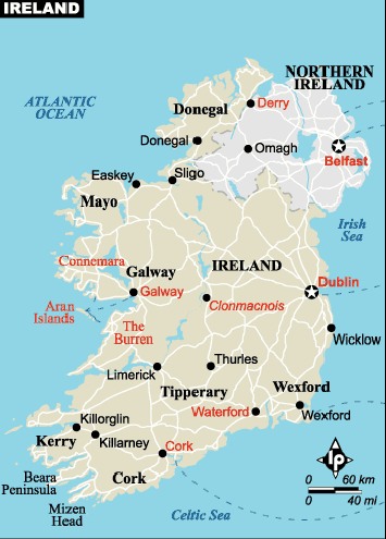
Conference Location
|
|
|
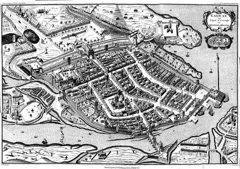
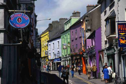
 Galway (Irish: Gaillimh) or City of Galway (Cathair na Gaillimhe) is a city in County Galway, Republic of Ireland. It is the fifth largest and the fastest-growing city in Ireland. It is also the third largest city in the Republic and the only city in the Province of Connacht. Located on the west coast of Ireland, it sits on the River Corrib between Lough Corrib and Galway Bay. The population of Galway city and its environs is 72,729 according to the 2006 census.
History
|
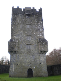
Dún Bhun na Gaillimhe ('Fort at the Mouth of the Gaillimh') was constructed in 1124, by the King of Connacht Tairrdelbach Ua Conchobair. The Annals of the Four Masters note that in that year "Three castles were erected by the Connaughtmen, the castle of Dun-Leodhar, the castle of the Gaillimh, and the castle of Cuil-maeile." This fort is also called a caislean (castle) in the annals. It was attacked in 1132 and 1149. Galway lay in the túath of Clann Fhergail which covered the parishes of St. Nicholas (the medieval city), Roscam and part of Baile an Chláir / Claregalway parish. This district was held by the Ó hAllmhuráin/O'Halloran clan. Clann Fhergail itself was a sub district of Uí Bhriúin Seola the territory of which is called Maigh Seola ('plain of Seola'). The Ó Flaithbheartaigh clan held it up until the Norman invasion of Connacht in the 1230s. As Dún Bhun na Gaillimhe lay in the territory of the O Flahertys they are often recorded as holding this fort for the O Connor Kings of Connacht. |
|
Following an unsuccessful week-long siege in 1230, Dún Bhun na Gaillimhe was captured by Richard Mor de Burgh in 1232. Over the following century Galway thrived under the de Burghs (Burkes), becoming a small walled town. After the sundering of the de Burgh (Clanrickards) dynasty in 1333, Galway sought its independence from the feuding Clanrickard Burkes , receiving a murage charter (authority to build a defensive wall) from the Crown in 1396. The English-oriented merchant families - known from the 1600's as The Tribes of Galway - were anxious to have control over their own affairs without the interference of the gaelicised Burkes. With independence from the Burkes achieved, Galway became to a large degree culturally and politically aloof (but not isolated) from the surrounding Gaelic and Gaelic-Norman territories. |
|
|
Galway received a municipal charter from the crown in December 1484. This ensured the town's independence from the Clanrickard Burkes. At the same time, the creation of the wardenship of Galway gave the townsmen control of the large parish church, St. Nicholas' Collegiate Church. |
|
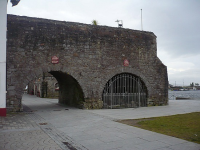
During the Middle Ages, Galway was ruled by an oligarchy of fourteen1 merchant families (12 of Anglo-Norman origin and 2 of Irish origin), the 'Tribes of Galway. The city thrived on international trade. In the Middle Ages, it was the principal Irish port for trade with Spain and France, being the main source of trade to the Western Isles, Scotland, during the Lordship of the Isles. The city thrived on international trade, and in the Middle Ages, it was the principal Irish port for trade with Spain and France. The most famous reminder of those days is ceann an bhalla ("the head of the wall"), now known as the Spanish Arch, constructed during the mayoralty of Wylliam Martin (1519–20). |
|
|
In 1477 Christopher Columbus visited Galway, possibly stopping off on a voyage to Iceland or the Faroe Islands. Seven or eight years later, he noted in the margin of his copy of Imago Mundi "Men of Cathay have come from the west. [Of this] we have seen many signs. And especially in Galway in Ireland, a man and a woman, of extraordinary appearance, have come to land on two tree trunks [or timbers? or a boat made of such?]" The most likely explanation for these bodies is that they were Inuit swept eastward by the North Atlantic Current |
|
After the Irish Rebellion of 1641, Galway was in a delicate position, caught, in effect between the Catholic rebels (Confederates) and its English garrison ensconced in Fort Hill just outside the city. Eventually, Galway citizens, who were predominantly Catholic, went against their garrison and supported the confederate side in 1642. The fort was besieged with the aid of Confederate troops until it surrendered and its garrison was evacuated by sea. During the 1640s, Galway was heavily fortified against an expected counter-attack by English forces, which eventually materialised when English Parliamentarian forces re-conquered Ireland in 1649-52. Galway surrendered to Cromwellian forces in 1652 after a nine-month siege; plague and expulsions of Catholic citizens followed. The Cromwellian Act of Settlement 1652 caused major upheavals, as peoples from east of the Shannon were transplanted to Connacht and slipped back. |
|
|
After the demise of the English Commonwealth and the English Restoration in 1660, (and the further Act of Settlement 1662 and its Act of Explanation 1665), the economy of Galway recovered somewhat. In the next crisis, centred around the deposition of the Catholic King James II, in 1689, Galway supported the Jacobite side. It surrendered without a siege under the Articles of Galway of 1691 after the annihilation of the main Jacobite army at the nearby battle of Aughrim. Thereafter, the city become an economic backwater, and the capital of its old great families were spent overseas. It took about 300 years for the city to regain its former status. |
|
After the 17th century wars, Galway, as a Catholic port city, was treated with great suspicion by the authorities. Legislation of 1704 (the Popery Act) stated that no new Catholics apart from seamen and day labourers could move there. On top of that, when fears arose of a French invasion of Ireland in 1708 and 1715 (during a Jacobite Rising in Scotland), all Catholics were ordered to leave the city. The corporation, which ran Galway was also confined to Protestants. This is all the more surprising given that a 1762 census showed thatof the town's 15,000 or so inhabitants, only 350 were Protestants. The persecution of Galway's old Catholic merchant elite meant that trade declined substantially, and the once busy harbour fell into disrepair. Local traders compensated to some degree for this by smuggling in goods like brandy through gaps in the town walls. On 1 November 1755 the 1755 Lisbon earthquake caused a two-metre tsunami to hit the city's coast, causing some serious damage to the "Spanish Arch" section of the city wall. |
|
|
Galway's economy recovered somewhat from the late 18th as the Penal Laws were relaxed. However the city's rural hinterland suffered terribly in the Great Irish Famine on the 1840s. Unlike other urban centres in 19th century Ireland, which experienced an explosion in their populations, Galway's population actually declined such was the devastation wrought by the famine. |
|
Galway city played a relatively minor role in the upheaval in Ireland from 1916-1923. In 1916, during the Easter Rising, Liam Mellows mobilised the local Irish Volunteers in the area to attack the Royal Irish Constabulary barracks at Oranmore, just outside Galway, however they failed to take it and later surrendered in Athenry. During the Irish War of Independence 1919-21, Galway was the western headquarters for the British Army. Their overhwelming force in the city meant that the local Irish Republican Army could do little against them. The only initiatives were taken by the University battalion of the IRA, who were reprimanded by the local IRA commander who was afraid they would provoke reprisals. This fear was not without justification, as the nearby town of Tuam was sacked on two occasions by the Black and Tans in July and September 1920. In November 1920, a Galway city Catholic priest, Fr. Michael Griffin was abducted and shot by the British forces. His body was found in a bog in Barna. Galway businessmen launched a boycott against Northern Irish goods from December 1919 onwards in protest against the loyalist attacks on Catholic nationalists in Belfast, a protest that later spread throughout the country. |
|
|
Before the outbreak of the Irish Civil War (1922–23), in March 1922, Galway saw a tense stand off between Pro-Treaty and Anti-Treaty troops over who would occupy the military barracks at Renmore. After fighting broke out in July 1922 the city and its military barracks were occupied by troops of the Irish Free State's National Army. Two Free State soldiers and one Anti-Treaty fighter were killed and more wounded before the National Army secured the area. The Republicans burned a number of public buildings in the centre of town before they abandoned Galway. |
Parts of this text were copied from 
 Conference Venue
|
|
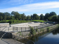
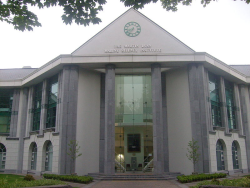
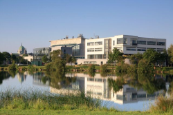
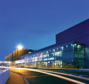
This year the Game-On conference will be held in the west of Ireland in the beautiful scenic city of Galway. Situated along the banks of the River Corrib, NUI Galway, boasts an impressive 260 acre campus with picturesque grounds, excellent accomodation, a choice of restaurants and first class amenities. |
How to reach Galway and the conference venue 
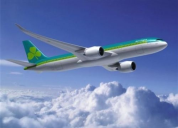
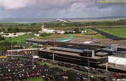
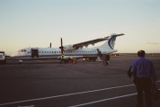
By Plane |
|
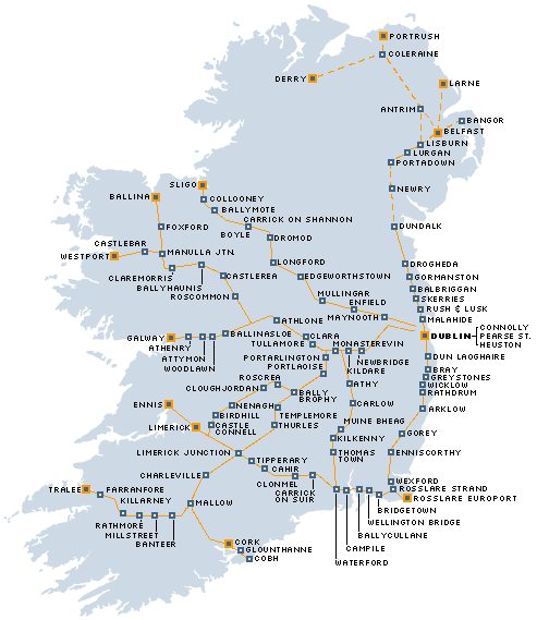
By Train |
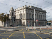
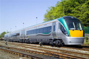
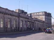
When you have arrived in Dublin and you wish to take the train then go to Heuston station from where all Galway trains depart. Galway's main railway station is Ceannt Station (Stáisiún Cheannt) Iarnród Éireann, Ireland's national rail operator, currently runs six return passenger services each day between Galway and Dublin Heuston, also serving intermediate stations. Travel time is just under 3 hours.
|
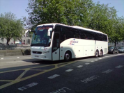
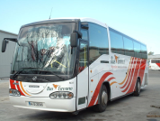
By Coach and Bus |
National coach services
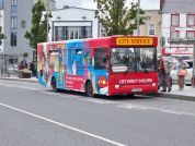
Local and County Galway Buses |
By Taxi |
Taxis can be taken at the train station to the University. |
By Car |
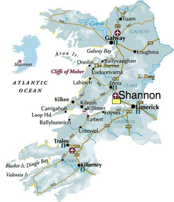
Three national primary roads serve the city: the N17 leading North (Tuam, Sligo, Donegal Town, Letterkenny and Derry), the M6 motorway from the East (Athlone, Dublin), and the N18 from the South (Shannon Town, Limerick and Cork). There is also an Inner City Ring (Cuar Inmheánach) route that encircles the city centre, most of which is pedestrianised. |
On Foot
|
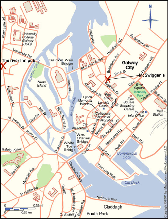
See the maps below how to walk to the University |

![]() You can also have a look on the NUI how to get there weblinks here
You can also have a look on the NUI how to get there weblinks here
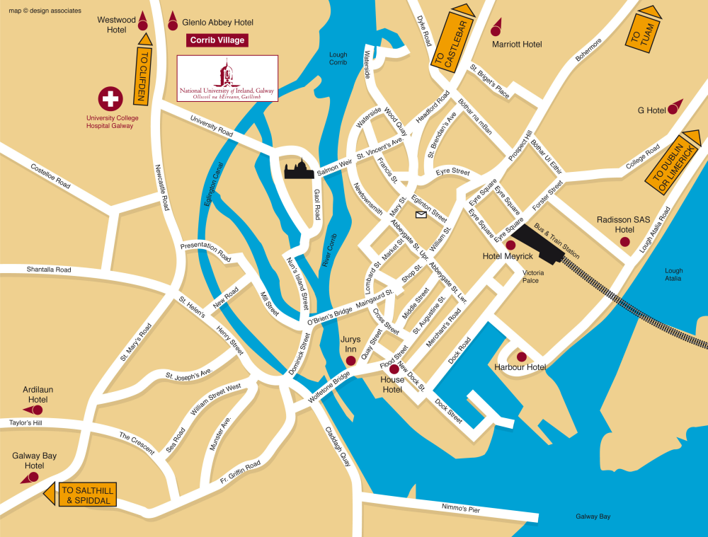
Galway Maps
|
|
Click on the maps above for a more detailed view