Venue
|
Istanbul
İstanbul
|
|
|---|---|
|
Levent business district
|
|
| Coordinates: 41°00′49″N 28°57′18″E / 41.01361°N 28.95500°E | |
| Country | |
| Region | Marmara |
| Province | Istanbul |
| Provincial seat | Cağaloğlu, Fatih |
| Districts | 39 |
| Government | |
| • Type | Mayor–council government |
| • Body | Municipal Council of Istanbul |
| • Mayor | Ekrem İmamoğlu (CHP) |
| Area | |
| • Urban | 2,576.85 km2 (994.93 sq mi) |
| • Metro | 5,343.22 km2 (2,063.03 sq mi) |
| Highest elevation | 537 m (1,762 ft) |
|
Population
(31 December 2023)
|
|
| • Metropolitan municipality and province | 15,655,924 |
| • Rank | 1st in Turkey
1st in Europe |
| • Urban | 15,305,657 |
| • Urban density | 5,939/km2 (15,380/sq mi) |
| • Metro density | 2,930/km2 (7,600/sq mi) |
| Demonym(s) | Istanbulite (Turkish: İstanbullu) |
| GDP Nominal (2022) | |
| • Total | $276 billion |
| • Per capita | $17,349 |
| Time zone | UTC+3 (TRT) |
| Postal code |
34000 to 34990
|
| Area codes | +90 212 (European side) +90 216 (Asian side) |
| Vehicle registration | 34 |
| HDI (2021) | 0.867 (very high) · 1st |
| GeoTLD | .ist, .istanbul |
| Website | |
| Official name | Historic Areas of Istanbul |
| Criteria | Cultural: (i)(ii)(iii)(iv) |
| Reference | 356bis |
| Inscription | 1985 (9th Session) |
| Extensions | 2017 |
| Area | 765.5 ha (1,892 acres) |
Istanbul (Turkish: İstanbul) is the largest city in Turkey, serving as the country's economic, cultural and historic hub. The city straddles the Bosporus Strait, lying in both Europe and Asia, and has a population of over 15 million residents, comprising 19% of the population of Turkey. Istanbul is the most populous European city and the world's 15th largest city.
The city was founded as Byzantium (Greek: Βυζάντιον, Byzantion) in the 7th century BCE by Greek settlers from Megara. In 330 CE, the Roman emperor Constantine the Great made it his imperial capital, renaming it first as New Rome (Greek: Νέα Ῥώμη, Nea Rhomē; Latin: Nova Roma) and then as Constantinople (Constantinopolis) after himself. In 1930, the city's name was officially changed to Istanbul, the Turkish rendering of εἰς τὴν Πόλιν (romanized: eis tḕn Pólin; 'to the City'), the appellation Greek speakers used since the 11th century to colloquially refer to the city.
The city served as an imperial capital for almost 1600 years: during the Roman/Byzantine (330–1204), Latin (1204–1261), late Byzantine (1261–1453), and Ottoman (1453–1922) empires. The city grew in size and influence, eventually becoming a beacon of the Silk Road and one of the most important cities in history. The city played a key role in the advancement of Christianity during Roman/Byzantine times, hosting four of the first seven ecumenical councils before its transformation to an Islamic stronghold following the Fall of Constantinople in 1453 CE—especially after becoming the seat of the Ottoman Caliphate in 1517. In 1923, after the Turkish War of Independence, Ankara replaced the city as the capital of the newly formed Republic of Turkey.
Istanbul has surpassed London and Dubai to become the most visited city in the world, with more than 20 million foreign visitors in 2023. The historic centre of Istanbul is a UNESCO World Heritage Site, and the city hosts the headquarters of numerous Turkish companies, accounting for more than thirty percent of the country's economy.
History
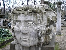
Neolithic artifacts, uncovered by archeologists at the beginning of the 21st century, indicate that Istanbul's historic peninsula was settled as far back as the 6th millennium BCE. That early settlement, important in the spread of the Neolithic Revolution from the Near East to Europe, lasted for almost a millennium before being inundated by rising water levels. The first human settlement on the Asian side, the Fikirtepe mound, is from the Copper Age period, with artifacts dating from 5500 to 3500 BCE, On the European side, near the point of the peninsula (Sarayburnu), there was a Thracian settlement during the early 1st millennium BCE. Modern authors have linked it to the Thracian toponym Lygos, mentioned by Pliny the Elder as an earlier name for the site of Byzantium.
The history of the city proper begins around 660 BCE, when Greek settlers from Megara established Byzantium on the European side of the Bosporus. The settlers built an acropolis adjacent to the Golden Horn on the site of the early Thracian settlements, fueling the nascent city's economy. The city experienced a brief period of Persian rule at the turn of the 5th century BCE, but the Greeks recaptured it during the Greco-Persian Wars. Byzantium then continued as part of the Athenian League and its successor, the Second Athenian League, before gaining independence in 355 BCE. Long allied with the Romans, Byzantium officially became a part of the Roman Empire in 73 CE. Byzantium's decision to side with the Roman usurper Pescennius Niger against Emperor Septimius Severus cost it dearly; by the time it surrendered at the end of 195 CE, two years of siege had left the city devastated. Five years later, Severus began to rebuild Byzantium, and the city regained—and, by some accounts, surpassed—its previous prosperity.
Rise and fall of Constantinople and the Byzantine Empire
Constantine the Great effectively became the emperor of the whole of the Roman Empire in September 324. Two months later, he laid out the plans for a new, Christian city to replace Byzantium. As the eastern capital of the empire, the city was named Nova Roma; most called it Constantinople, a name that persisted into the 20th century. On 11 May 330, Constantinople was proclaimed the capital of the Roman Empire, which was later permanently divided between the two sons of Theodosius I upon his death on 17 January 395, when the city became the capital of the Eastern Roman (Byzantine) Empire.
The establishment of Constantinople was one of Constantine's most lasting accomplishments, shifting Roman power eastward as the city became a center of Greek culture and Christianity. Numerous churches were built across the city, including Hagia Sophia which was built during the reign of Justinian the Great and remained the world's largest cathedral for a thousand years. Constantine also undertook a major renovation and expansion of the Hippodrome of Constantinople; accommodating tens of thousands of spectators, the hippodrome became central to civic life and, in the 5th and 6th centuries, the center of episodes of unrest, including the Nika riots. Constantinople's location also ensured its existence would stand the test of time; for many centuries, its walls and seafront protected Europe against invaders from the east and the advance of Islam. During most of the Middle Ages, the latter part of the Byzantine era, Constantinople was the largest and wealthiest city on the European continent and at times the largest in the world. Constantinople is generally considered to be the center and the "cradle of Orthodox Christian civilization".
Constantinople began to decline continuously after the end of the reign of Basil II in 1025. The Fourth Crusade was diverted from its purpose in 1204, and the city was sacked and pillaged by the crusaders. They established the Latin Empire in place of the Orthodox Byzantine Empire. Hagia Sophia was converted to a Catholic church in 1204. The Byzantine Empire was restored, albeit weakened, in 1261. Constantinople's churches, defenses, and basic services were in disrepair, and its population had dwindled to a hundred thousand from half a million during the 8th century. After the reconquest of 1261, however, some of the city's monuments were restored, and some, like the two Deesis mosaics in Hagia Sophia and Kariye, were created.
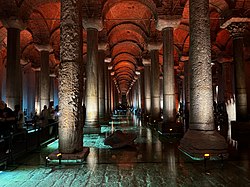
Various economic and military policies instituted by Andronikos II, such as the reduction of military forces, weakened the empire and left it vulnerable to attack. In the mid-14th-century, the Ottoman Turks began a strategy of gradually taking smaller towns and cities, cutting off Constantinople's supply routes and strangling it slowly. On 29 May 1453, after an eight-week siege (during which the last Roman emperor, Constantine XI, was killed), Sultan Mehmed II "the Conqueror" captured Constantinople.
Ottoman Empire
Sultan Mehmed declared Constantinople the new capital of the Ottoman Empire. Hours after the fall of the city, the sultan rode to the Hagia Sophia and summoned an imam to proclaim the Islamic creed, converting the grand cathedral into an imperial mosque due to the city's refusal to surrender peacefully. Mehmed declared himself as the new Kayser-i Rûm (the Ottoman Turkish equivalent of the Caesar of Rome) and the Ottoman state was reorganized into an empire.

Byzantium 667 BC–510 BC
Persian Empire 512 BC–478 BC
Byzantium (Under Athens) 478 BC–404 BC
Byzantium 404 BC–196 CE
Roman Empire 196–395 (Capital between 330–395)
Byzantine Empire 395–1204
Latin Empire 1204–1261
Byzantine Empire 1261–1453
Ottoman Empire 1453–1918
Occupation of Istanbul 1918–1923
Ankara Government 1923
Turkey 1923–Present
Following the capture of Constantinople, Mehmed II immediately set out to revitalize the city. Cognizant that revitalization would fail without the repopulation of the city, Mehmed II welcomed everyone–foreigners, criminals, and runaways– showing extraordinary openness and willingness to incorporate outsiders that came to define Ottoman political culture. He also invited people from all over Europe to his capital, creating a cosmopolitan society that persisted through much of the Ottoman period. Revitalizing Istanbul also required a massive program of restorations, of everything from roads to aqueducts. Like many monarchs before and since, Mehmed II transformed Istanbul's urban landscape with wholesale redevelopment of the city center. There was a huge new palace to rival, if not overshadow, the old one, a new covered market (still standing as the Grand Bazaar), porticoes, pavilions, walkways, as well as more than a dozen new mosques. Mehmed II turned the ramshackle old town into something that looked like an imperial capital.
Social hierarchy was ignored by the rampant plague, which killed the rich and the poor alike in the 16th century. Money could not protect the rich from all the discomforts and harsher sides of Istanbul. Although the Sultan lived at a safe remove from the masses, and the wealthy and poor tended to live side by side, for the most part Istanbul was not zoned as modern cities are. Opulent houses shared the same streets and districts with tiny hovels. Those rich enough to have secluded country properties had a chance of escaping the periodic epidemics of sickness that blighted Istanbul.

The Ottoman Dynasty claimed the status of caliphate in 1517, with Constantinople remaining the capital of this last caliphate for four centuries. Suleiman the Magnificent's reign from 1520 to 1566 was a period of especially great artistic and architectural achievement; chief architect Mimar Sinan designed several iconic buildings in the city, while Ottoman arts of ceramics, stained glass, calligraphy, and miniature flourished. The population of Constantinople was 570,000 by the end of the 18th century.
A period of rebellion at the start of the 19th century led to the rise of the progressive Sultan Mahmud II and eventually to the Tanzimat period, which produced political reforms and allowed new technology to be introduced to the city. Bridges across the Golden Horn were constructed during this period, and Constantinople was connected to the rest of the European railway network in the 1880s. Modern facilities, such as a water supply network, electricity, telephones, and trams, were gradually introduced to Constantinople over the following decades, although later than to other European cities. The modernization efforts were not enough to forestall the decline of the Ottoman Empire.
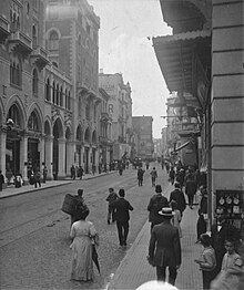
With the Young Turk Revolution in 1908, the Ottoman Parliament, closed since 14 February 1878, was reopened 30 years later on 23 July 1908, which marked the beginning of the Second Constitutional Era. The civil strife and political uncertainties in the Ottoman Empire during the months after the revolution encouraged Austria-Hungary to annex Bosnia and Bulgaria to declare its independence in a jointly coordinated move on 5 October 1908. Sultan Abdul Hamid II was deposed in 1909, following the counter-revolution attempt known as the 31 March incident. A series of wars in the early 20th century, such as the Italo-Turkish War (1911–1912) and the Balkan Wars (1912–1913), plagued the ailing empire's capital and resulted in the 1913 Ottoman coup d'état, which brought the regime of the Three Pashas.
The Ottoman Empire joined World War I (1914–1918) on the side of the Central Powers and was ultimately defeated. The deportation of Armenian intellectuals on 24 April 1915 was among the major events which marked the start of the Armenian genocide during WWI. Due to Ottoman and Turkish policies of Turkification and ethnic cleansing, the city's Christian population declined from 450,000 to 240,000 between 1914 and 1927. The Armistice of Mudros was signed on 30 October 1918 and the Allies occupied Constantinople on 13 November 1918. The Ottoman Parliament was dissolved by the Allies on 11 April 1920 and the Ottoman delegation led by Damat Ferid Pasha was forced to sign the Treaty of Sèvres on 10 August 1920.[citation needed]
Following the Turkish War of Independence (1919–1922), the Grand National Assembly of Turkey in Ankara abolished the Sultanate on 1 November 1922, and the last Ottoman Sultan, Mehmed VI, was declared persona non grata. Leaving aboard the British warship HMS Malaya on 17 November 1922, he went into exile and died in Sanremo, Italy, on 16 May 1926.
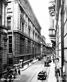
The Treaty of Lausanne was signed on 24 July 1923, and the occupation of Constantinople ended with the departure of the last forces of the Allies from the city on 4 October 1923. Turkish forces of the Ankara government, commanded by Şükrü Naili Pasha (3rd Corps), entered the city with a ceremony on 6 October 1923, which has been marked as the Liberation Day of Istanbul (Turkish: İstanbul'un Kurtuluşu) and is commemorated every year on its anniversary.
Turkish Republic
On 29 October 1923 the Grand National Assembly of Turkey declared the establishment of the Turkish Republic, with Ankara as its capital. Mustafa Kemal Atatürk became the Republic's first President.
A 1942 wealth tax assessed mainly on non-Muslims led to the transfer or liquidation of many businesses owned by religious minorities. From the late 1940s and early 1950s, Istanbul underwent great structural change, as new public squares, boulevards, and avenues were constructed throughout the city, sometimes at the expense of historical buildings. The population of Istanbul began to rapidly increase in the 1970s, as people from Anatolia migrated to the city to find employment in the many new factories that were built on the outskirts of the sprawling metropolis. This sudden, sharp rise in the city's population caused a large demand for housing, and many previously outlying villages and forests became engulfed into the metropolitan area of Istanbul.
Climate
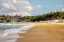
Istanbul's climate is temperate, and is often described as transitional between the Mediterranean climate typical of the western and southern coasts of Turkey, and the oceanic climate of the northwestern coasts of the country. Much divergence exists in the terminology used to classify the city's climate, however.
The city's summers are warm to hot and moderately dry, with an average daytime temperature of about 28 °C (82 °F), and less than 7 days of precipitation per month. Despite the generally acceptable temperature range, however, mid-summer in Istanbul is considered moderately uncomfortable, due to high dew points and relative humidity. Winters, meanwhile, are cool, quite rainy, and relatively snow-rich for a city with above-freezing average temperatures.
Istanbul's precipitation is unevenly distributed, with winter months getting at least twice the level of precipitation of their summerly counterparts. The mode of precipitation also varies by season. Winter precipitation is generally light, persistent and often of mixed precipitation such as rain-snow mixes and graupel; while summer precipitation is generally abrupt and sporadic. Cloudiness, as with precipitation, varies greatly by season. Winters are quite cloudy, with around 20 percent of days being sunny or partly cloudy. Meanwhile, summers experience 60-70 percent of possible sunshine.
Snowfall is sporadic, but accumulates virtually every winter; and when it does, it is highly disruptive to city infrastructure. Sea-effect snowstorms with more than 30 centimetres (1 ft) of snowfall happen almost annually, most recently in 2022.
| Climate data for Kireçburnu (normals 1991–2020, precipitation days and sunshine 1981-2010; see the main article for more information) | |||||||||||||
|---|---|---|---|---|---|---|---|---|---|---|---|---|---|
| Month | Jan | Feb | Mar | Apr | May | Jun | Jul | Aug | Sep | Oct | Nov | Dec | Year |
| Mean daily maximum °C (°F) | 8.8 (47.8) |
9.4 (48.9) |
12.0 (53.6) |
16.1 (61.0) |
21.0 (69.8) |
25.7 (78.3) |
28.0 (82.4) |
28.2 (82.8) |
24.6 (76.3) |
19.9 (67.8) |
15.0 (59.0) |
10.7 (51.3) |
18.3 (64.9) |
| Daily mean °C (°F) | 5.9 (42.6) |
6.1 (43.0) |
8.0 (46.4) |
11.5 (52.7) |
16.3 (61.3) |
21.1 (70.0) |
23.7 (74.7) |
24.2 (75.6) |
20.5 (68.9) |
16.2 (61.2) |
11.7 (53.1) |
7.9 (46.2) |
14.4 (58.0) |
| Mean daily minimum °C (°F) | 3.6 (38.5) |
3.5 (38.3) |
4.9 (40.8) |
8.1 (46.6) |
12.8 (55.0) |
17.4 (63.3) |
20.3 (68.5) |
21.2 (70.2) |
17.4 (63.3) |
13.6 (56.5) |
9.2 (48.6) |
5.5 (41.9) |
11.5 (52.6) |
| Average precipitation mm (inches) | 96.1 (3.78) |
87.7 (3.45) |
69.8 (2.75) |
45.1 (1.78) |
37.1 (1.46) |
44.7 (1.76) |
36.3 (1.43) |
43.5 (1.71) |
81.3 (3.20) |
98.3 (3.87) |
100.5 (3.96) |
124.8 (4.91) |
865.2 (34.06) |
| Average precipitation days (≥ 0.1 mm) | 16.9 | 15.2 | 13.2 | 10.0 | 7.4 | 7.0 | 4.7 | 5.1 | 8.1 | 12.3 | 13.9 | 17.5 | 131.3 |
| Average snowy days (≥ 0.1 cm) | 4.5 | 4.7 | 2.9 | 0.1 | 0.0 | 0.0 | 0.0 | 0.0 | 0.0 | 0.0 | 0.3 | 2.7 | 15.2 |
| Average relative humidity (%) | 79.8 | 78.6 | 75.8 | 75.1 | 76.5 | 75.7 | 75.3 | 75.9 | 75.0 | 78.4 | 78.9 | 78.4 | 76.9 |
| Mean monthly sunshine hours | 68.2 | 89.6 | 142.6 | 180.0 | 248.0 | 297.6 | 319.3 | 288.3 | 234.0 | 158.1 | 93.0 | 62.0 | 2,180.7 |
| Percent possible sunshine | 22 | 29 | 38 | 46 | 57 | 64 | 69 | 66 | 65 | 46 | 31 | 22 | 46 |
| Source: | |||||||||||||
Climate change
As with virtually every part of the world, climate change is causing more heatwaves, droughts, storms, and flooding in Istanbul. Furthermore, as Istanbul is a large and rapidly expanding city, its urban heat island has been intensifying the effects of climate change. If trends continue, sea level rise is likely to affect city infrastructure, for example Kadıkoy metro station is threatened with flooding. Xeriscaping of green spaces has been suggested, and Istanbul has a climate-change action plan, but not a net zero target.
Cityscape
Districts and neighborhoods
European side
The Fatih district, which was named after Sultan Mehmed II (Turkish: Fatih Sultan Mehmed), corresponds to what was, until the Ottoman conquest in 1453, the whole of the city of Constantinople (today is the capital district and called the historic peninsula of Istanbul) on the southern shore of the Golden Horn, across the medieval Genoese citadel of Galata on the northern shore. The Genoese fortifications in Galata were largely demolished in the 19th century, leaving only the Galata Tower, to make way for the northward expansion of the city. Galata (Karaköy) is today a quarter within the Beyoğlu (Pera) district, which forms Istanbul's commercial and entertainment center and includes İstiklal Avenue and Taksim Square.
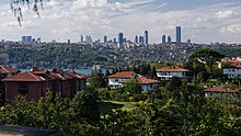
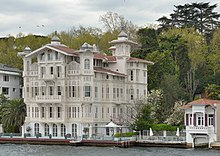
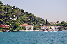
Dolmabahçe Palace, the seat of government during the late Ottoman period, is in the Beşiktaş district on the European shore of the Bosporus strait, to the north of Beyoğlu. The former village of Ortaköy is within Beşiktaş and gives its name to the Ortaköy Mosque on the Bosporus, near the Bosporus Bridge. Lining both the European and Asian shores of the Bosporus are the historic yalıs, luxurious chalet mansions built by Ottoman aristocrats and elites as summer homes. Inland, north of Taksim Square is the Istanbul Central Business District, a set of corridors lined with office buildings, residential towers, shopping centers, and university campuses, and over 2,000,000 m2 (22,000,000 sq ft) of class-A office space in total. Maslak, Levent, and Bomonti are important nodes within the CBD.
The Atatürk Airport corridor is another such edge city-style business, residential and shopping corridor with over 900,000 m2 (9,700,000 sq ft) of class-A office space.
Asian side
During the Ottoman period, Üsküdar (then Scutari) and Kadıköy were outside the scope of the urban area, serving as tranquil outposts with seaside yalıs and gardens. But in the second half of the 20th century, the Asian side experienced major urban growth; the late development of this part of the city led to better infrastructure and tidier urban planning when compared with most other residential areas in the city. Much of the Asian side of the Bosporus functions as a suburb of the economic and commercial centers in European Istanbul, accounting for a third of the city's population but only a quarter of its employment. However, Kozyatağı–Ataşehir, Altunizade, Kavacık and Ümraniye, all together having around 1.4 million sqm of class-A office space) are now important "edge cities", i.e. corridors and nodes of business and shopping centers and of tall residential buildings.
Expansion
As a result of Istanbul's exponential growth in the 20th century, a significant portion of the city is composed of gecekondus (literally "built overnight"), referring to illegally constructed squatter buildings. At present, some gecekondu areas are being gradually demolished and replaced by modern mass-housing compounds. Moreover, large scale gentrification and urban renewal projects have been taking place, such as the one in Tarlabaşı; some of these projects, like the one in Sulukule, have faced criticism. The Turkish government also has ambitious plans for an expansion of the city west and northwards on the European side in conjunction with the new Istanbul Airport, opened in 2019; the new parts of the city will include four different settlements with specified urban functions, housing 1.5 million people.
Parks

Istanbul does not have a primary urban park, but it has several green areas. Gülhane Park and Yıldız Park were originally included within the grounds of two of Istanbul's palaces — Topkapı Palace and Yıldız Palace—but they were repurposed as public parks in the early decades of the Turkish Republic. Another park, Fethi Paşa Korusu, is on a hillside adjacent to the Bosphorus Bridge in Anatolia, opposite Yıldız Palace in Europe. Along the European side, and close to the Fatih Sultan Mehmet Bridge, is Emirgan Park, which was known as the Kyparades (Cypress Forest) during the Byzantine period. In the Ottoman period, it was first granted to Nişancı Feridun Ahmed Bey in the 16th century, before being granted by Sultan Murad IV to the Safavid Emir Gûne Han in the 17th century, hence the name Emirgan. The 47-hectare (120-acre) park was later owned by Khedive Ismail Pasha of Ottoman Egypt and Sudan in the 19th century. Emirgan Park is known for its diversity of plants and an annual tulip festival is held there since 2005. The AKP government's decision to replace Taksim Gezi Park with a replica of the Ottoman era Taksim Military Barracks (which was transformed into the Taksim Stadium in 1921, before being demolished in 1940 for building Gezi Park) sparked a series of nationwide protests in 2013 covering a wide range of issues. Popular during the summer among Istanbulites is Belgrad Forest, spreading across 5,500 hectares (14,000 acres) at the northern edge of the city. The forest originally supplied water to the city and remnants of reservoirs used during Byzantine and Ottoman times survive.
Architecture

Istanbul is primarily known for its Byzantine and Ottoman architecture. Despite its development as a Turkish city since 1923, it contains many ancient, Roman, Byzantine, Christian, Muslim, and Jewish monuments.
The Neolithic settlement in the Yenikapı quarter on the European side, which dates back to c. 6500 BCE and predates the formation of the Bosporus strait by approximately a millennium (when the Sea of Marmara was still a lake) was discovered during the construction of the Marmaray railway tunnel. It is the oldest known human settlement on the European side of the city. The oldest known human settlement on the Asian side is the Fikirtepe Mound near Kadıköy, with relics dating to c. 5500-3500 BCE (Chalcolithic period).
There are numerous ancient monuments in the city. The most ancient is the Obelisk of Thutmose III (Obelisk of Theodosius). Built of red granite, 31 m (100 ft) high, it came from the Temple of Karnak in Luxor, and was erected there by Pharaoh Thutmose III (r. 1479–1425 BCE) to the south of the seventh pylon. The Roman emperor Constantius II (r. 337–361 CE) had it and another obelisk transported along the River Nile to Alexandria for commemorating his ventennalia or 20 years on the throne in 357. The other obelisk was erected on the spina of the Circus Maximus in Rome in the autumn of that year, and is now known as the Lateran Obelisk. The obelisk that would become the Obelisk of Theodosius remained in Alexandria until 390 CE, when Theodosius I (r. 379–395 CE) had it transported to Constantinople and put up on the spina of the Hippodrome there. When re-erected at the Hippodrome of Constantinople, the obelisk was mounted on a decorative base, with reliefs that depict Theodosius I and his courtiers. The lower part of the obelisk was damaged in antiquity, probably during its transport to Alexandria in 357 CE or during its re-erection at the Hippodrome of Constantinople in 390 CE. As a result, the current height of the obelisk is only 18.54 meters, or 25.6 meters if the base is included. Between the four corners of the obelisk and the pedestal are four bronze cubes, used in its transportation and re-erection.
Next in age is the Serpent Column, from 479 BCE. It was brought from Delphi in 324 CE, during the reign of Constantine the Great, and also erected at the spina of the Hippodrome. It was originally part of an ancient Greek sacrificial tripod in Delphi that was erected to commemorate the Greeks who fought and defeated the Persian Empire at the Battle of Plataea (479 BCE). The three serpent heads of the 8-meter (26 ft) high column remained intact until the end of the 17th century (one is on display at the nearby Istanbul Archaeology Museums).
Built in porphyry and erected at the center of the Forum of Constantine in 330 CE to mark the founding of the new Roman capital, the Column of Constantine was originally adorned with a sculpture of the Roman emperor Constantine the Great depicted as the solar god Apollo on its top, which fell in 1106 and was later replaced by a cross during the reign of Byzantine emperor Manuel Komnenos (r. 1143–1180).
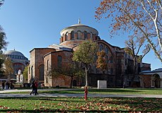
There are traces of the Byzantine era throughout the city, from ancient churches that were built over early Christian meeting places like the Hagia Irene, the Chora Church, the Monastery of Stoudios, the Church of Sts. Sergius and Bacchus, the Church of Theotokos Pammakaristos, the Monastery of the Pantocrator, the Monastery of Christ Pantepoptes, the Hagia Theodosia, the Church of Theotokos Kyriotissa, the Monastery of Constantine Lips, the Church of Myrelaion, the Hagios Theodoros, etc.; to palaces like the Great Palace of Constantinople and its Mosaic Museum, the Palace of the Porphyrogenitus, Boukoleon Palace and Palace of Blachernae; and other public places and buildings like the Hippodrome, the Augustaion, the Basilica Cistern, Theodosius Cistern, Cistern of Philoxenos and Cistern of the Hebdomon, the Aqueduct of Valens, the Prison of Anemas, the Walls of Constantinople and the Porta Aurea (Golden Gate), among numerous others. The 4th century Harbor of Theodosius in Yenikapı, once the busiest port in Constantinople, was among the numerous archeological discoveries that took place during the excavations of the Marmaray tunnel.
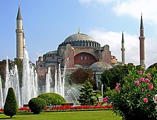
However, it is the Hagia Sophia that fully conveys the period of Constantinople as a city without parallel in Christendom. The Hagia Sophia, topped by a dome 31 meters (102 ft) in diameter over a square space defined by four arches, is the pinnacle of Byzantine architecture. The Hagia Sophia stood as the world's largest cathedral in the world until it was converted into a mosque in the 15th century. The minarets date from that period. Because of its historical significance, it was reopened as a museum in 1935. However, it was re-converted into a mosque in July 2020.

Over the next four centuries, the Ottomans transformed Istanbul's urban landscape with a vast building scheme that included the construction of towering mosques and ornate palaces. The Sultan Ahmed Mosque (Blue Mosque), another landmark of the city, faces the Hagia Sophia at Sultanahmet Square (Hippodrome of Constantinople). The Süleymaniye Mosque, built by Suleiman the Magnificent, was designed by his chief architect Mimar Sinan, the most illustrious of all Ottoman architects, who designed many of the city's renowned mosques and other types of public buildings and monuments.
Among the oldest surviving examples of Ottoman architecture in Istanbul are the Anadoluhisarı and Rumelihisarı fortresses, which assisted the Ottomans during their siege of the city. Over the next four centuries, the Ottomans made an indelible impression on the skyline of Istanbul, building towering mosques and ornate palaces.
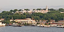
Topkapı Palace, dating back to 1465, is the oldest seat of government surviving in Istanbul. Mehmed II built the original palace as his main residence and the seat of government. The present palace grew over the centuries as a series of additions enfolding four courtyards and blending neoclassical, rococo, and baroque architectural forms. In 1639, Murad IV made some of the most lavish additions, including the Baghdad Kiosk, to commemorate his conquest of Baghdad the previous year. Government meetings took place here until 1786, when the seat of government was moved to the Sublime Porte. After several hundred years of royal residence, it was abandoned in 1853 in favor of the baroque Dolmabahçe Palace. Topkapı Palace became public property following the abolition of monarchy in 1922. After extensive renovation, it became one of Turkey's first national museums in 1924.
The imperial mosques include Fatih Mosque, Bayezid Mosque, Yavuz Selim Mosque, Süleymaniye Mosque, Sultan Ahmed Mosque (the Blue Mosque), and Yeni Mosque, all of which were built at the peak of the Ottoman Empire, in the 16th and 17th centuries. In the following centuries, and especially after the Tanzimat reforms, Ottoman architecture was supplanted by European styles. An example of which is the imperial Nuruosmaniye Mosque. Areas around İstiklal Avenue were filled with grand European embassies and rows of buildings in Neoclassical, Renaissance Revival and Art Nouveau styles, which went on to influence the architecture of a variety of structures in Beyoğlu—including churches, stores, and theaters—and official buildings such as Dolmabahçe Palace.
Culture
Istanbul was historically known as a cultural hub, but its cultural scene stagnated after the Turkish Republic shifted its focus toward Ankara. The new national government established programs that served to orient Turks toward musical traditions, especially those originating in Europe, but musical institutions and visits by foreign classical artists were primarily centered in the new capital.
Much of Turkey's cultural scene had its roots in Istanbul, and by the 1980s and 1990s Istanbul reemerged globally as a city whose cultural significance is not solely based on its past glory.
By the end of the 19th century, Istanbul had established itself as a regional artistic center, with Turkish, European, and Middle Eastern artists flocking to the city. Despite efforts to make Ankara Turkey's cultural heart, Istanbul had the country's primary institution of art until the 1970s. When additional universities and art journals were founded in Istanbul during the 1980s, artists formerly based in Ankara moved in.

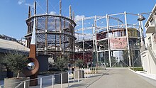
Beyoğlu has been transformed into the artistic center of the city, with young artists and older Turkish artists formerly residing abroad finding footing there. Modern art museums, including İstanbul State Art and Sculpture Museum, National Palaces Painting Museum, İstanbul Modern, the Pera Museum, Sakıp Sabancı Museum, Arter and SantralIstanbul, opened in the 2000s to complement the exhibition spaces and auction houses that have already contributed to the cosmopolitan nature of the city. These museums have yet to attain the popularity of older museums on the historic peninsula, including the Istanbul Archaeology Museums, which ushered in the era of modern museums in Turkey, and the Turkish and Islamic Arts Museum.
The first film screening in Turkey was at Yıldız Palace in 1896, a year after the technology publicly debuted in Paris. Movie theaters rapidly cropped up in Beyoğlu, with the greatest concentration of theaters being along the street now known as İstiklal Avenue. Istanbul also became the heart of Turkey's nascent film industry, although Turkish films were not consistently developed until the 1950s. Since then, Istanbul has been the most popular location to film Turkish dramas and comedies. The Turkish film industry ramped up in the second half of the century, and with Uzak (2002) and My Father and My Son (2005), both filmed in Istanbul, the nation's movies began to see substantial international success. Istanbul and its picturesque skyline have also served as a backdrop for several foreign films, including From Russia with Love (1963), Topkapi (1964), The World Is Not Enough (1999), and Mission Istaanbul (2008).
Coinciding with this cultural reemergence was the establishment of the Istanbul Festival, which began showcasing a variety of art from Turkey and around the world in 1973. From this flagship festival came the International Istanbul Film Festival and the Istanbul Jazz Festival in the early 1980s. With its focus now solely on music and dance, the Istanbul Festival has been known as the Istanbul International Music Festival since 1994. The most prominent of the festivals that evolved from the original Istanbul Festival is the Istanbul Biennial, held every two years since 1987. Its early incarnations were aimed at showcasing Turkish visual art, and it has since opened to international artists and risen in prestige to join the elite biennales, alongside the Venice Biennale and the São Paulo Art Biennial.
Leisure and entertainment

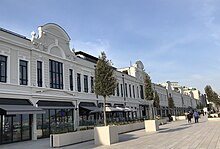
Abdi İpekçi Street in Nişantaşı, Galataport Shopping Area in Karaköy and Bağdat Avenue on the Anatolian side of the city have evolved into high-end shopping districts. Other focal points for shopping, leisure and entertainment include Nişantaşı, Ortaköy, Bebek and Kadıköy. The city has numerous shopping centers, from the historic to the modern. Istanbul also has an active nightlife and historic taverns, a signature characteristic of the city for centuries, if not millennia.
The Grand Bazaar, in operation since 1461, is among the world's oldest and largest covered markets. Mahmutpasha Bazaar is an open-air market extending between the Grand Bazaar and the Spice Bazaar, which has been Istanbul's major spice market since 1660.
Galleria Ataköy ushered in the age of modern shopping malls in Turkey when it opened in 1987. Since then, malls have become major shopping centers outside the historic peninsula. Akmerkez was awarded the titles of "Europe's best" and "World's best" shopping mall by the International Council of Shopping Centers in 1995 and 1996; Istanbul Cevahir has been one of the continent's largest since opening in 2005; and Kanyon won the Cityscape Architectural Review Award in the Commercial Built category in 2006. Zorlu Center and İstinye Park are among the other upscale malls in Istanbul which include the stores of the world's top fashion brands.

Along İstiklal Avenue is the Çiçek Pasajı (Flower Passage), a 19th-century shopping gallery which is today home to winehouses (known as meyhanes), pubs and restaurants. İstiklal Avenue, originally known for its taverns, has shifted toward shopping, but the nearby Nevizade Street is still lined with winehouses and pubs. Some other neighborhoods around İstiklal Avenue have been revamped to cater to Beyoğlu's nightlife, with formerly commercial streets now lined with pubs, cafes, and restaurants playing live music.

Istanbul is known for its historic seafood restaurants. Many of the city's most popular and upscale seafood restaurants line the shores of the Bosporus (particularly in neighborhoods like Ortaköy, Bebek, Arnavutköy, Yeniköy, Beylerbeyi and Çengelköy). Kumkapı along the Sea of Marmara has a pedestrian zone that hosts around fifty fish restaurants.
The Princes' Islands, 15 kilometers (9 mi) from the city center, are also popular for their seafood restaurants. Because of their restaurants, historic summer mansions, and tranquil, car-free streets, the Princes' Islands are a popular vacation destination among Istanbulites and foreign tourists.
Istanbul is also famous for its sophisticated and elaborately-cooked dishes of the Ottoman cuisine. Following the influx of immigrants from southeastern and eastern Turkey, which began in the 1960s, the city's foodscape has drastically changed by the end of the century; with influences of Middle Eastern cuisine such as kebab taking an important place in the food scene.
Restaurants featuring foreign cuisines are mainly concentrated in the Beyoğlu, Beşiktaş, Şişli and Kadıköy districts.
Apart from the city's numerous stadiums, sports halls and concert halls, there are several open-air venues for concerts and festivals, such as the Cemil Topuzlu Open-Air Theatre in Harbiye, Paraf Kuruçeşme Open-Air on the Bosphorus shore in Kuruçeşme, and Parkorman in the forest of Maslak. The annual Istanbul Jazz Festival has been held every year since 1994. Organized between 2003 and 2013, Rock'n Coke was the biggest open-air rock festival in Turkey, sponsored by Coca-Cola. It was traditionally held at the Hezarfen Airfield in Istanbul.

The Istanbul International Music Festival has been held annually since 1973, and the International Istanbul Film Festival has been held annually since 1982. The Istanbul Biennial is a contemporary art exhibition that has been held biennially since 1987. The Istanbul Shopping Fest is an annual shopping festival held since 2011, and Teknofest is an annual festival of aviation, aerospace and technology, held since 2018.
When it was held for the first time in 2003, the annual Istanbul Pride became the first gay pride event in a Muslim-majority country. Since 2015, all types of parades at Taksim Square and İstiklal Avenue (where, in 2013, the Gezi Park protests took place) have been denied permission by the AKP government, citing security concerns, but hundreds of people have defied the ban each year. Critics have claimed that the bans were in fact due to ideological reasons.
Parts of this text and pictures were copied from 
Conference Venue
|
|
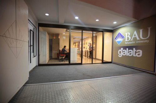
Getting to Istanbul and BUG, Bahçeşehir University, Game Lab 
By Plane   |
When arriving by plane in Istanbul you will arrive at either the new Istanbul International Airport, located in the Arnavutköy district to the northwest of the city center, on the European side, near the Black Sea coast, or at the Sabiha Gökçen International Airport, 45 kilometers (28 mi) southeast of the city center, on the Asian side. it is used predominantly by low-cost carriers.Link on the webpages of the airports give further information on bus, metro and taxi connections from the respective airports. |
|
By Metro   |
Istanbul's local public transportation system is a network of commuter rail, trams, funiculars, metro lines, buses, bus rapid transit, and ferries. Fares across modes are integrated, using the contactless Istanbulkart, introduced in 2009. Operated by Istanbul Electricity, Tramway and Tunnels General Management (İETT), the Istanbul nostalgic tram and a faster modern tram line, which now carries 265,000 passengers each day. The Istanbul Metro comprises ten lines (the M1, M2, M3, M6, M7, M9 and M11 on the European side, and the M4, M5 and M8 on the Asian side) with several other lines (M12 and M14) and extensions under construction. The two sides of Istanbul's metro are connected under the Bosphorus by the Marmaray Tunnel, inaugurated in 2013 as the first rail connection between Thrace and Anatolia, having 13.5 km (8.4 mi) length.The Marmaray tunnel together with the suburban railways lines along the Sea of Marmara, form the intercontinental commuter rail line in Istanbul, named officially B1, from Halkalı on the European side to Gebze on the Asian side. This rail line has 76.6 km (47.6 mi). |
|
By Bus  |
The Bus and Metrobus |
|
By Taxi |
You can find taxis outside the Airport buildings. (see Airports) |
|
On Foot
|
All selected hotels are within walking distance of the University. |
BUG Lab TEKMER (BUG LAB Teknoloji Geliştirme Merkezi) Location Map


