Venue
Palma | |
|---|---|
City and Municipality | |
| Palma | |
 View of Palma Bay, from Bellver Castle | |
 Flag  Coat of arms | |
| Nickname(s): Ciutat de Mallorca (commonly shortened to Ciutat) | |
 Palma shown within Mallorca | |
| Coordinates: 39°34′N 2°39′E / 39.567°N 2.650°ECoordinates: 39°34′N 2°39′E / 39.567°N 2.650°E | |
| Sovereign state | |
| Autonomous community | |
| Province | |
| Island | |
| Comarca | Palma |
| Judicial district | Palma |
| Founded | 124 BC |
| Administrative HQ | Palma |
| Government | |
| • Type | Municipal corporation |
| • Body | Ajuntament de Palma |
| • Mayor | Antoni Noguera Ortega (Més) |
| Area | |
| • City and Municipality | 208.63 km2 (80.55 sq mi) |
| Elevation | 13 m (43 ft) |
| Population (2018)[2] | |
| • City and Municipality | 409,661 |
| • Density | 2,000/km2 (5,100/sq mi) |
| • Urban | 550,000[1] |
| Demonym(s) | palmesà, -ana (ca) palmesano, -na (es) |
| Time zone | UTC+1 (Central European Time) |
| • Summer (DST) | UTC+2 (Central European Summer Time) |
| Postal code | 070XX |
| Dialing code | 971 |
| Website | www.palma.cat |


Palma de Mallorca, since December 2016 Palma[3] (/ˈpɑːlmə/ or /ˈpɑːmə/, Catalan: [ˈpalmə], Spanish: [ˈpalma]), is the capital and largest city of the autonomous community of the Balearic Islands in Spain.[4] It is situated on the south coast of Mallorca on the Bay of Palma. The Cabrera Archipelago, though widely separated from Palma proper, is administratively considered part of the municipality. As of 2018[update], Palma de Mallorca Airport serves over 29 million passengers per year.
History
Palma was founded as a Roman camp upon the remains of a Talaiotic settlement. The city was subjected to several Vandal raids during the fall of the Western Roman Empire, then reconquered by the Byzantine Empire, then colonised by the Moors (who called it Medina Mayurqa) and, in the 13th century, by James I of Aragon.
Roman period
After the conquest of Mallorca, the city was loosely incorporated into the province of Tarraconensis by 123 BC; the Romans founded two new cities: Palma on the south of the island, and Pollentia in the northeast — on the site of a Phoenician settlement. Whilst Pollentia acted as a port to Roman cities on the northwestern Mediterranean Sea, Palma was the port used for destinations in Africa, such as Carthage, and Hispania, such as Saguntum, Gades and Carthago Nova. Though present-day Palma has no significant remains from this period, occasional archaeological finds are made in city centre excavations. For example, the remains of the Roman Wall can be seen at Can Bordils, the Municipal Archive, and below it, at the Maimó ben Faraig Center.[1]
Byzantine period
Though the period between the fall of the Western Roman Empire and the Muslim conquest is not well understood (due to lack of documents), there is clear evidence of a Byzantine presence in the city, as indicated by mosaics found in the oldest parts of the Cathedral, which was in early medieval times part of a paleo-Christian temple.
Muslim period
Between 902 and 1229, the city was under Islamic control. It remained the capital of the island and it was known as Medina Mayurqa, which in Arabic means "City of Majorca".
Under the Emirate of Córdoba
The arrival of the Moors in the Balearic Islands occurred at the beginning of the 8th century. During this period, the population developed an economy based on self-sufficiency and piracy, and even showed evidence of a relative hierarchy. The dominant groups took advantage of the Byzantine withdrawal due to Islamic expansion across the Mediterranean, to reinforce their domination upon the rest of the population, thus ensuring their power and the gradual abandonment of Imperial political structures.
In 707, a Muslim fleet, under the command of Abd Allgaht ibn Musa, son of the governor of Ifriqiya, Musa ibn Nusayr, stopped off at the island. It appears that Abd Allah convinced the powers of the city to accept a peace treaty. This treaty was granted in exchange for a tax, respect for social, economic and political structures to the communities that subscribed to it, as well as the continuity of their religious beliefs.
After 707, the city was inhabited by Christians who were nominally in allegiance to the sovereignty of the Umayyad Caliphate, yet who, de facto, enjoyed absolute autonomy. The city, being in Mallorca, constituted an enclave between western Christian and Islamic territories, and this attracted and encouraged increased levels of piracy in the surrounding waters. For wide sectors of the city's population, the sacking of ships (whether Muslim or Christian) which passed through Balearic waters was a source of riches over the next fifteen decades. Eventually, continued piracy in the region lead to a retaliation by Al-Andalus which launched a naval fleet against the city and the whole of the Islands. The Islands were defended by the emperor Charlemagne in 799 from a Muslim pirate incursion.
In 848 (maybe 849), four years after the first Viking incursions had sacked the whole island, an attack from Córdoba forced the authorities to ratify the treaty to which the city had submitted in 707. As the city still occupied an eccentric position regarding the commerce network established by the Moors in the western Mediterranean, the enclave was not immediately incorporated into Al-Andalus.
While the Emirate of Córdoba reinforced its influence upon the Mediterranean, Al-Andalus increased its interest in the city. The consequence of this was the substitution of the submission treaty for the effective incorporation of the islands to the Islamic state. A squad under the command of Isam al-Jawlani took advantage of instability caused by several Viking incursions and disembarked in Mallorca, and after destroying any resistance, incorporated Mallorca, with Palma as its capital, to the Córdoban state.
The incorporation of the city into the Emirate set the basis for a new society. Commerce and manufacturing developed in a manner that was previously unknown. This caused considerable demographic growth, thereby establishing Medina Mayurqa as one of the major ports for trading goods in and out of the Emirate of Córdoba.
Dénia—Balearic taifa (1015–1087)

The Umayyad regime, despite its administrative centralisation, mercenary army and struggle to gain wider social support, could neither harmonise the various ethnic groups inside al-Andalus nor dissolve the old tribes which still organised sporadic ethnic fighting. During the 11th century, the Caliphate's control waned considerably. Provinces broke free from the central Cordoban administration, and became effectively sovereign states — taifas — under the same governors that had been named by the last Umayyad Caliphs. According to their origin, these "taifas" can be grouped under three broad categories: people of Arab, Berber or Slavic origin.
Palma was part of the taifa of Dénia. The founder of this state was a client of the Al-Mansur family, Muyahid ibn Yusuf ibn Ali, who could profit from the progressive crumbling of the Caliphate's superstructure to gain control over the province of Dénia. Subsequently, Muyahid organised a campaign throughout the Balearic Islands to consolidate the district and incorporated it into their "taifa" in early 1015.
During the following years Palma became the main port from where attacks on Christian vessels and coasts could be launched. Palma was the base from where a campaign against Sardinia was launched between 1016 and 1017, which caused the Pisans and Genoese forces to intervene. Later, this intervention set the basis for Italian mercantile penetration of the city.
The Denian dominion lasted until 1087, a period during which the city, as well as the rest of the islands, was relatively peaceful. Their supremacy at sea was still not rivalled by the Italian merchant republics, thus there were few external threats.
Balearic Taifa (1087–1115) and Western Mediterranean

The Banu Hud conquest of Dénia and its incorporation to the Eastern district of the taifa of Zaragoza meant the destruction of the legacy of Muyahid. The islands were freed from mainland dominion and briefly enjoyed independence, during which Medina Mayurqa was the capital.
The economy during this period depended on both agriculture and piracy. In the latter 11th century, Christian commercial powers took the initiative at sea against the Muslims. After centuries of fighting defensively in the face of Islamic pressure, Italians, Catalans and Occitans took offensive action. Consequently, the benefits of piracy diminished causing severe economic stress on the city.
The clearest proof of the new ruling relation of forces, from 1090, is the Crusade organised by the most important mercantile cities of the Christian states against the Islands. This effort was destined to finally eradicate Muslim piracy mainly based in Palma and surrounding havens. In 1115, Palma was sacked and later abandoned by an expedition commanded by Ramon Berenguer III the Great, count of Barcelona and Provence, which was composed of Catalans, Pisans and other Italians, and soldiers from Provence, Corsica, and Sardinia, in a struggle to end Almoravid control.
After this, the Islands became part of the Almoravid dynasty. The inglobement of all the taifa to a larger state helped to re-establish a balance along the frontier that separated western Christian states from the Muslim world.
Period of the Banu Ganiya (1157–1203)
The situation changed in the mid-12th century, when the Almoravids were displaced from al-Andalus and western Maghreb by the Almohad. Almoravid dominions, from 1157 on, were restricted to the Balearic Islands, with Palma again acting as the capital, governed by Muhammad ibn Ganiya. Massive arrival of al-Andalus refugees contributed to reinforce the positions of the last Almoravid legitimatists, the Banu Ganiya, who, conscious of their weakness in the Western Mediterranean context, started to get closer to the growing powers represented by Italian maritime republics. Genoa and Pisans obtained in this period their first commercial concessions in the city and the rest of the islands.
The Banu Ganiya, taking advantage of the great loss suffered by Abu Yuqub Yusuf in the Siege of Santarém, attacked Ifriqiya, where the Almohad dominion had not been consolidated yet, in the same year. However, this attack was repelled and the Almohad authorities encouraged anti-Almoravid revolts in the Islands. The city was captured by the Almohads in 1203.
Christian reconquest and late Middle Ages

On 31 December 1229, after three months of siege, the city was reconquered by James I of Aragon and was renamed Ciutat de Mallorca (Mallorca City). In addition to being kept as capital of the Kingdom of Majorca, it was given a municipality that comprised the whole island. The governing arm was the University of the City and Kingdom of Majorca.
After the death of James I of Aragon, Palma became joint capital of the Kingdom of Majorca, together with Perpignan. His son, James II of Majorca, championed the construction of statues and monuments in the city: Bellver Castle, the churches of St. Francesc and St. Domingo, reformed the Palace of Almudaina and began the construction of the Cathedral of Majorca.

In 1391, anti-Jewish riots broke out. The Jewish community of Inca was completely wiped out, as were those of Sóller, Sineu, and Alcudia. In spite of the governor's prohibition on leaving the island, many Jews fled to North Africa. The remaining Jews were forced to convert under threat of death.[2]
Abraham Cresques was a 14th-century Jewish cartographer of the Majorcan cartographic school from Palma; Cresques is credited with the authorship of the famous Catalan Atlas.
The river that cut through the city gave rise to two distinct areas within the city; the "Upper town" and "Lower town", depending upon which side of the river one was situated.

The city's advantageous geographical location allowed it extensive commerce with Catalonia, Valencia, Provence, the Maghreb, the Italian republics and the dominions of the Great Turk, which heralded a golden age for the city.
At the beginning of the 16th century, the Rebellion of the Brotherhoods (a peasant uprising against Charles V's administration) and the frequent attack of Turkish and Berber pirates caused a reduction of commercial activities and a huge inversion in defensive structures. As a consequence, the city entered a period of decadence that would last till the end of the 17th century.
17th to 19th centuries
.JPG)
The 17th century is characterised by the division of the city in two sides or gangs, named Canamunts and Canavalls (from Majorcan Catalan "the ones from the upper/lower side"), with severe social and economical repercussions. During this period the port became a haven for pirates. During the last quarter of the century, the Inquisition continued its persecution of the city's Jews, locally called xuetes.
The fall of Barcelona in 1714 meant the end of the War of the Spanish Succession and the defeat and destruction of the Crown of Aragon, and this was reflected on the Nueva Planta decrees, issued by Philip V of Spain in 1715. These occupation decrees changed the government of the island and separated it from the municipality's government of Palma, which became the official city name. By the end of the 19th century, the name Palma de Mallorca was generalised in written Spanish, although it is still colloquially named Ciutat ("city") in Catalan. In the 18th century Charles III of Spain removed interdiction of commerce with Spanish colonies in America and the port and commercial activity of the city grew once again.
At the beginning of the 19th century, Palma became a refuge for many who had exiled themselves from the Napoleonic occupation of Catalonia and Valencia; during this period freedom flourished, until the absolutist restoration. With the establishment of contemporary Spanish state administrative organization, Palma became the capital of the new province of Balearic Islands in the 1833 territorial division of Spain. The French occupation of Algeria in the 19th century ended the fear of Maghrebi attacks in Majorca, which favoured the expansion of new maritime routes, and consequently, the economic growth of the city.
Modern period

Since the advent of mass tourism in the 1950s, the city has been transformed into a tourist destination and has attracted many workers from mainland Spain. This has contributed to a huge change in the city's traditions, its language, and its economic power.
The boom in tourism has caused Palma to grow significantly. In 1960, Mallorca received 500,000 visitors, in 1997 it received more than 6,739,700. In 2001 more than 19,200,000 people passed through Son Sant Joan airport near Palma, with an additional 1.5 million coming by sea.
In the 21st century, urban redevelopment, by the so-called Pla Mirall (English "Mirror Plan"), had attracted groups of immigrant workers from outside the European Union, especially from Africa and South America.
More than half of the population works in tourism, approximately 80%, therefore being the main economic portal of Palma. Tourism has affected the rapid economic growth of Palma, making the island of Mallorca wealthier compared to other regions in Spain.
The second economic portal of Palma is agriculture. Main exports of Palma's agriculture are, almonds, oranges, lemons and olives. The island is also gifted with a wide variety of natural resources, such as mines of copper, lead and marble.[3]
The city also has several surrounding neighborhood communities including Establiments, Nord, Son Espanyol, Ses Cases Noves, and Sa Creu Vermella.[4]
Geography

Palma is a major city and seaport located in the southwest of Mallorca, a western mediterranean island belonging to the Balearic Islands archipelago. The land area of the city is about 21.355 square kilometres (8.245 sq mi) with an altitude of 13 metres (43 feet) above sea level.
The city center of Palma is located north of the homonymous bay (Badia de Palma in the local Catalan language). The area that extends eastwards is mostly a flat fertile plain known as Es Pla. To the north and west, the city borders the Serra de Tramuntana, the island's major mountain range and a Unesco World Heritage site.
Population
.PNG)
As of the 2009[update] census, the population of the city of Palma proper was 401,270,[citation needed] and the population of the entire urban area was 550,000,[1] making it the twelfth largest urban area of Spain. Almost half of the total population of Mallorca live in Palma.
As of 2017[update] over 60,000 non-Spanish foreigners registered with the town hall lived in Palma; the registered foreign population from 2016 to 2017 declined by 832, the numerically highest decline in the Balearics.[2]
Climate
Palma has a Mediterranean climate, the climate classification named after the sea surrounding the city. There is a significant marine influence to warm winters, but summers are warmed by the surrounding continental landmasses.
| ||||||||||||||||||||||||||||||||||||||||||||||||||||||||||||||||||||||||||||||||||||||||||||||||||||||||||||||||||||||||||||||||||||||||||||||||||||||||||||||||||||||||
| ||||||||||||||||||||||||||||||||||||||||||||||||||||||||||||||||||||||||||||||||||||||||||||||||||||||||||||||||||||||||||||||||||||||||||||||||||||||||||||||||||||||||
Main sights
Plaça d'Espanya
The Plaça d'Espanya is the transport hub of Palma. The Estació Intermodal caters for buses and trains (the latter controlled by TIB). The two old buildings are home to the tourist information centre and several cafés sit either side of the two large escalators which lead into the Estació, which sits underneath a large and popular park. On the lawns are several glass boxes, which let in light and ventilation to the station below ground. There are also train-themed playing structures, each one shaped like a train carriage and named after towns along the line of the Ferrocarril de Sóller, a railway dating back to 1911 which has its Palma Station right next to the park. Just down the street from here a new bus station is under construction. At the centre of the plaza is a statue of James I, Conquistador of Majorca.[1]
Cathedral area
Palma is famous for La Seu, its vast cathedral built on a previous mosque which was built atop an original Christian church. Although construction of the present Cathedral began in 1229, it did not finish until 1601. Local architect Antoni Gaudí was drafted in to restore the building in 1901. The Parc de la Mar (Park of the Sea) lies just south, overlooked by the great building which sits above it on the city's stone foundations. Between the two are the town walls.
The Rocks
The rocks located a short walk from the cathedral are a place of calm and tranquility.
Old city


The Old City (in the south-east area of Palma behind the cathedral) is a maze of streets clearly hinting at an Arab past.[citation needed] With the exception of a few streets and squares which allow traffic and are populated with tourists most of the time, the walkways of this city quarter are fairly narrow, quiet streets, surrounded by a diverse range of interesting buildings, the architecture of which is comparable to cities such as Florence. The majority are private houses, some of which are open to the public as discreet museums or galleries. The Old City is also home to the Ajuntament (or Town Hall), the Convent of the Cathedral and the Banys Àrabs.
Banys Àrabs


The Banys Àrabs, or Arab Baths, one of the few remnants of Palma's Moorish past, are accessed via the quiet Ca'n Serra street near the Convent of the Cathedral, and include the lush gardens of Ca'n Fontirroig, home to Sardinian warblers, house sparrows, cacti, palm trees and a wide range of flowers and ferns. The small two-roomed brick building that once housed the baths is of Byzantine origin, dating back to the 11th century and possibly once part of the home of a Muslim nobleman. The bathroom has a cupola with five oculi which let in dazzling light. The twelve columns holding up the small room were pillaged from an earlier Roman construction. The floor over the hypocaust has been worn away by people standing in the centre, mainly to photograph the entrance and the garden beyond it. The whole room is in a rather dilapidated condition. The other room is a brick cube with a small model of the baths as they once were in the corner.
Parts of this text and pictures were copied from 
Conference Venue
|
|
Getting to Palma de Mallorca and Universitat de les Illes Balears - Sa Riera Hall
By Plane


|
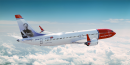
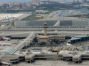
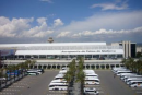
As Palma de Mallorca is a popular tourist destination it is easily reachable by plane from all over Europe. When arriving by plane in Palma de Mallorca, you will land at
Palma de Mallorca Airport located 8 km east of Palma,
Majorca, Spain.
By Bus |
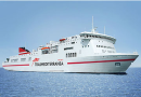
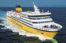
By Ferry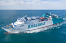
|
You can reach Mallorca from Barcelona, València and Dénia with Balearia, and from Barcelona and València with Transmediterranea. You can also reach Mallorca from Toulon with Corsica ferries. |
By Train and Metro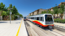
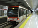
|
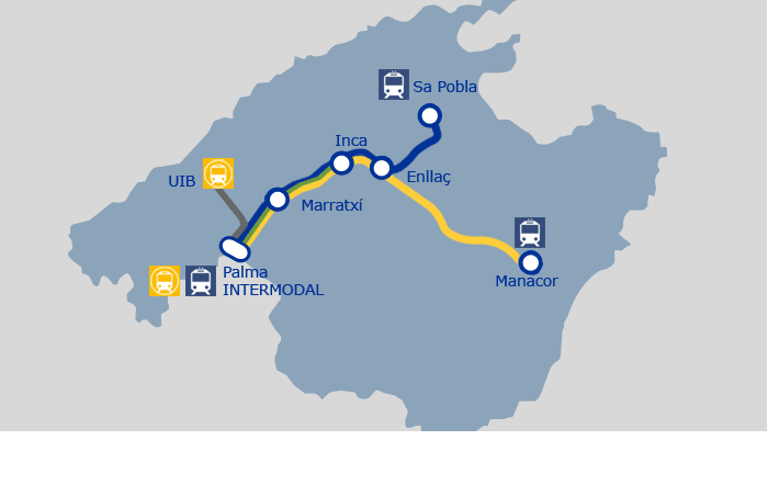
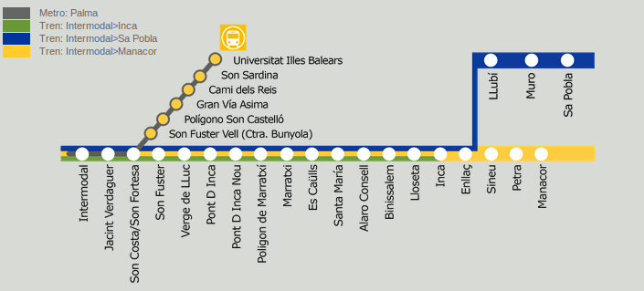
Mallorca has a small railway service that connects the capital, Palma, with several towns and villages on the island. It's divided into three routes which run between Palma and Inca, Sa Pobla,
Manacor, Marratxí, Santa María, Consell, Binissalem, Lloseta, Muro, Sineu and Petra.
There are also two metro lines in the city of Palma.Train and metro routes are operated by SFM (Serveis Ferroviaris de Mallorca). All of them depart and end at Palma
'Estació Intermodal', situated in Plaça d'Espanya.
Updated information can also be found on the TIB (Transports de les Illes Balears) website. |
By Tram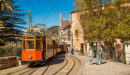 |
The 'Orange Express' tram from Sóller to Port de Sóller runs hourly, connecting with the arrival of the Sóller vintage train. Stand on the platform as it clatters through orchards and back gardens and you can imagine you are living 50 years earlier. It takes 20 minutes to complete the 5km journey to the port. If you do not want to return the same way, buses leave from the jetty for Palma via Deià and Valldemossa. |
By Bus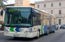 |
Palma has its own bus service run by EMT (look out for the blue buses). You pay for your journey when you get
on board - single tickets only (€1.50, or €3 for journeys on line 1 to the port). Drivers won't usually accept a note larger than €10. You can also buy a set of 10 journeys at a discounted
rate of €10 in tobacco shops and the EMT office (Josep Anselm Clavé 5, around the corner from Olivar Market). |
By Taxi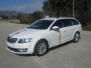 |
Taxis in Palma are white cars with a red and yellow stripe across the middle; they display a green light when free. They all have meters and will always use them so you do not need to worry
about being overcharged. |
By Car |
Palma de Mallorca city centre is about 9 km by car from the airport |
On Foot
|
All chosen hotels are within easy walking distance of the Universitat de les Illes Balears, Sa Riera Hall. (see hotel page) |

Universitat de les Illes Balears - Sa Riera Hall Location Map
Mallorca Train Metro Maps
|
|