Venue
Dublin Baile Átha Cliath | |
|---|---|
Capital city | |

Clockwise, from top: Samuel Beckett Bridge,
Trinity College,
The Custom House,
Dublin Castle,
O'Connell Bridge,
Convention Centre | |

Flag  Coat of arms | |
| Nickname(s): The Fair City | |
| Motto(s): Obedientia Civium Urbis Felicitas 'The Obedience of the citizens produces a happy city'. Alternatively translated as 'An Obedient Citizenry Produces a Happy City' | |

Dublin Location within Ireland 
Dublin Location within Europe | |
| Coordinates: 53°21′N 6°16′W / 53.350°N 6.267°W Coordinates: 53°21′N 6°16′W / 53.350°N 6.267°W | |
| Country | Ireland |
| Province | Leinster |
| • European Parliament | Dublin constituency |
| Area | |
| • Capital city | 115 km2 (44 sq mi) |
| • Urban | 318 km2 (123 sq mi) |
| Population | |
| • Capital city | 554,554 |
| • Density | 4,811/km2 (12,460/sq mi) |
| • Urban | 1,173,179 |
| • Metro | 1,347,359 |
| • Greater Dublin | 1,904,806 |
| • Ethnicity (2011 Census) | Ethnic groups
|
| Demonyms | Dubliner, Dub |
| Time zone | UTC0 (GMT) |
| • Summer (DST) | UTC+1 (IST) |
| Eircode | D01 to D18, D20, D22, D24 & D6W |
| Area code(s) | 01 (+3531) |
| GDP | €106 billion |
| GDP per capita | €79,000 |
| Website | www |
Dublin (/ ˈdʌbl ɪn/, locally /ˈdʊb-/; Irish: Baile Átha Cliath [ˈbˠalʲə aːhə ˈclʲiə; ˌbʲlʲaː ˈclʲiə]) is the capital and largest city of Ireland. Situated on a bay on the east coast, at the mouth of the River Liffey, it lies within the province of Leinster. It is bordered on the south by the Dublin Mountains, a part of the Wicklow Mountains range. It has an urban area population of 1,173,179, while the population of the Dublin Region (formerly County Dublin) as of 2016[update] was 1,347,359. The population of the Greater Dublin Area was 1,904,806 per the 2016 census.
There is archaeological debate regarding precisely where Dublin was established by the Gaels in or before the 7th century AD. Later expanded as a Viking settlement, the Kingdom of Dublin, the city became Ireland's principal settlement following the Norman invasion. The city expanded rapidly from the 17th century and was briefly the second largest city in the British Empire before the Acts of Union in 1800. Following the partition of Ireland in 1922, Dublin became the capital of the Irish Free State, later renamed Ireland.
Dublin is a historical and contemporary centre for education, the arts, administration and industry. As of 2018[update] the city was listed by the Globalization and World Cities Research Network (GaWC) as a global city, with a ranking of "Alpha −", which places it amongst the top thirty cities in the world.
History
The area of Dublin Bay has been inhabited by humans since prehistoric times, but the writings of Ptolemy (the Greco-Roman astronomer and cartographer) in about AD 140 provide possibly the earliest reference to a settlement there. He called it Eblana polis (Greek: Ἔβλανα πόλις).
Dublin celebrated its 'official' millennium in 1988, meaning the Irish government recognised 988 as the year in which the city was settled and that this first settlement would later become the city of Dublin.

It is now thought the Viking settlement of about 841 was preceded by a Christian ecclesiastical settlement known as Duibhlinn, from which Dyflin took its name. Beginning in the 9th and 10th century, there were two settlements which later became the modern Dublin. The subsequent Scandinavian settlement centred on the River Poddle, a tributary of the Liffey in an area now known as Wood Quay. The Dubhlinn was a pool on the lowest stretch of the Poddle, used to moor ships. This pool was finally fully infilled during the early 18th century, as the city grew. The Dubhlinn lay where the Castle Garden is now located, opposite the Chester Beatty Library within Dublin Castle. Táin Bó Cuailgne ("The Cattle Raid of Cooley") refers to Dublind rissa ratter Áth Cliath, meaning "Dublin, which is called Ath Cliath".
Middle Ages
Dublin was established as a Viking settlement in the 10th century and, despite a number of attacks by the native Irish, it remained largely under Viking control until the Norman invasion of Ireland was launched from Wales in 1169. It was upon the death of Muirchertach Mac Lochlainn in early 1166 that Ruaidrí Ua Conchobair, King of Connacht, proceeded to Dublin and was inaugurated King of Ireland without opposition.
According to some historians, part of the city's early economic growth is attributed to a trade in slaves. Slavery in Ireland and Dublin reached its pinnacle in the 9th and 10th centuries. Prisoners from slave raids and kidnappings, which captured men, women and children, brought revenue to the Gaelic Irish Sea raiders, as well as to the Vikings who had initiated the practice. The victims came from Wales, England, Normandy and beyond.
The King of Leinster, Diarmait Mac Murchada, after his exile by Ruaidhrí, enlisted the help of Strongbow, the Earl of Pembroke, to conquer Dublin. Following Mac Murrough's death, Strongbow declared himself King of Leinster after gaining control of the city. In response to Strongbow's successful invasion, King Henry II of England affirmed his ultimate sovereignty by mounting a larger invasion in 1171 and pronounced himself Lord of Ireland. Around this time, the county of the City of Dublin was established along with certain liberties adjacent to the city proper. This continued down to 1840 when the barony of Dublin City was separated from the barony of Dublin. Since 2001, both baronies have been redesignated as the City of Dublin.

Dublin Castle, which became the centre of Norman power in Ireland, was founded in 1204 as a major defensive work on the orders of King John of England. Following the appointment of the first Lord Mayor of Dublin in 1229, the city expanded and had a population of 8,000 by the end of the 13th century. Dublin prospered as a trade centre, despite an attempt by King Robert I of Scotland to capture the city in 1317. It remained a relatively small walled medieval town during the 14th century and was under constant threat from the surrounding native clans. In 1348, the Black Death, a lethal plague which had ravaged Europe, took hold in Dublin and killed thousands over the following decade.
Dublin was incorporated into the English Crown as the Pale, which was a narrow strip of English settlement along the eastern seaboard. The Tudor conquest of Ireland in the 16th century spelt a new era for Dublin, with the city enjoying a renewed prominence as the centre of administrative rule in Ireland. Determined to make Dublin a Protestant city, Queen Elizabeth I of England established Trinity College in 1592 as a solely Protestant university and ordered that the Catholic St. Patrick's and Christ Church cathedrals be converted to Protestant.
The city had a population of 21,000 in 1640 before a plague in 1649–51 wiped out almost half of the city's inhabitants. However, the city prospered again soon after as a result of the wool and linen trade with England, reaching a population of over 50,000 in 1700.
Early modern
.jpg)
As the city continued to prosper during the 18th century, Georgian Dublin became, for a short period, the second largest city of the British Empire and the fifth largest city in Europe, with the population exceeding 130,000. The vast majority of Dublin's most notable architecture dates from this period – the Four Courts, the Custom House, Temple Bar and Grafton Street are some of the few remaining areas that were not affected by the wave of Georgian reconstruction and maintained their medieval character.[citation needed]
Dublin grew even more dramatically during the 18th century, with the construction of many new districts and buildings, such as Merrion Square, Parliament House and the Royal Exchange. The Wide Streets Commission was established in 1757 at the request of Dublin Corporation to govern architectural standards on the layout of streets, bridges and buildings. In 1759, the Guinness brewery was founded; and would eventually grow to become the largest brewery in the world and the largest employer in Dublin.
Late modern and contemporary

Dublin suffered a period of political and economic decline during the 19th century following the Acts of Union 1800, under which the seat of government was transferred to the Westminster Parliament in London. The city played no major role in the Industrial Revolution, but remained the centre of administration and a transport hub for most of the island. Ireland had no significant sources of coal, the fuel of the time, and Dublin was not a centre of ship manufacturing, the other main driver of industrial development in Britain and Ireland. Belfast developed faster than Dublin during this period on a mixture of international trade, factory-based linen cloth production and shipbuilding.
.jpg)
The Easter Rising of 1916, the Irish War of Independence, and the subsequent Irish Civil War resulted in a significant amount of physical destruction in central Dublin. The Government of the Irish Free State rebuilt the city centre and located the new parliament, the Oireachtas, in Leinster House. Since the beginning of Norman rule in the 12th century, the city has functioned as the capital in varying geopolitical entities: Lordship of Ireland (1171–1541), Kingdom of Ireland (1541–1800), as part of the United Kingdom of Great Britain and Ireland (1801–1922), and the Irish Republic (1919–1922). Following the partition of Ireland in 1922, it became the capital of the Irish Free State (1922–1937) and now is the capital of Ireland. One of the memorials to commemorate that time is the Garden of Remembrance.
Dublin was also a victim of the Northern Irish Troubles, although during this 30-year conflict, violence mainly occurred within Northern Ireland. However, the Provisional IRA drew some support from within the Republic, including from Dublin. A Loyalist paramilitary group, the Ulster Volunteer Force, bombed the city during this time – notably in an atrocity known as the Dublin and Monaghan bombings in which 34 people died, mainly in central Dublin.
Since 1997, the landscape of Dublin has changed. The city was at the forefront of Ireland's economic expansion during the Celtic Tiger period, with private sector and state development of housing, transport and business. Following an economic decline during the Great Recession, Dublin has rebounded and as of 2017[update] has close to full employment, but a significant problem with housing supply in both city and surrounds.
Geography
Landscape

Dublin is situated at the mouth of the River Liffey and encompasses a land area of approximately 115 square kilometres (44 sq mi) in east-central Ireland. It is bordered by the Dublin Mountains, a low mountain range and sub range of the Wicklow Mountains, to the south and surrounded by flat farmland to the north and west.
Watercourses
The River Liffey divides the city in two, between the Northside and the Southside. The Liffey bends at Leixlip from a northeasterly route to a predominantly eastward direction, and this point also marks the transition to urban development from more agricultural land usage.
Two secondary rivers further divide the city – the River Tolka, running southeast into Dublin Bay, and the River Dodder running northeast to near the mouth of the Liffey, and these and the Liffey have multiple tributaries. A number of lesser rivers and streams also flow to the sea.
Two canals – the Grand Canal on the southside and the Royal Canal on the northside – ring the inner city on their way from the west and the River Shannon.
Cultural divide
A north-south division once, to some extent, traditionally existed, with the River Liffey as the divider. The Northside was generally seen as working class to middle class, while the Southside was seen as middle class to upper-middle class, although containing "pockets" of working class life. There have also been some social divisions evident between the coastal suburbs in the east of the city, and the newer developments further to the west.
In some tourism and real-estate marketing contexts, inner Dublin is sometimes divided into a number of "quarters" or districts. These include, the 'Medieval Quarter' (in the area of Dublin Castle, Christ Church and St Patrick's Cathedral and the old city walls), the 'Georgian Quarter' (including the area around St Stephen's Green, Trinity College, and Merrion Square), the 'Docklands Quarter' (around the Dublin Docklands and Silicon Docks), the 'Cultural Quarter' (around Temple Bar), and 'Creative Quarter' (between South William Street and George's Street).
Climate
Similar to much of the rest of northwestern Europe, Dublin experiences a maritime climate (Cfb) with cool summers, mild winters, and a lack of temperature extremes. The average maximum January temperature is 8.8 °C (48 °F), while the average maximum July temperature is 20.2 °C (68 °F). On average, the sunniest months are May and June, while the wettest month is October with 76 mm (3 in) of rain, and the driest month is February with 46 mm (2 in). Rainfall is evenly distributed throughout the year.
Dublin's sheltered location on the east coast makes it the driest place in Ireland, receiving only about half the rainfall of the west coast. Ringsend in the south of the city records the lowest rainfall in the country, with an average annual precipitation of 683 mm (27 in), with the average annual precipitation in the city centre being 714 mm (28 in). The main precipitation in winter is rain; however snow showers do occur between November and March. Hail is more common than snow. The city experiences long summer days and short winter days. Strong Atlantic winds are most common in autumn. These winds can affect Dublin, but due to its easterly location, it is least affected compared to other parts of the country. However, in winter, easterly winds render the city colder and more prone to snow showers.
In the 20th century, smog and air-pollution were an issue in the city, precipitating a ban on bituminous fuels across Dublin. The ban was implemented in 1990 to address black smoke concentrations, that had been linked to cardiovascular and respiratory deaths in residents. Since the ban, non-trauma death rates, respiratory death rates and cardiovascular death rates have declined – by an estimated 350 deaths annually.
| Climate data for Dublin (DUB), 1981–2010 normals, extremes 1881–present | |||||||||||||
|---|---|---|---|---|---|---|---|---|---|---|---|---|---|
| Month | Jan | Feb | Mar | Apr | May | Jun | Jul | Aug | Sep | Oct | Nov | Dec | Year |
| Record high °C (°F) | 17.5 (63.5) |
18.1 (64.6) |
23.4 (74.1) |
22.7 (72.9) |
26.8 (80.2) |
28.7 (83.7) |
31.0 (87.8) |
30.6 (87.1) |
27.6 (81.7) |
24.2 (75.6) |
19.4 (66.9) |
17.1 (62.8) |
31.0 (87.8) |
| Average high °C (°F) | 8.1 (46.6) |
8.3 (46.9) |
10.2 (50.4) |
12.1 (53.8) |
14.8 (58.6) |
17.6 (63.7) |
19.5 (67.1) |
19.2 (66.6) |
17.0 (62.6) |
13.6 (56.5) |
10.3 (50.5) |
8.3 (46.9) |
13.3 (55.9) |
| Daily mean °C (°F) | 5.3 (41.5) |
5.3 (41.5) |
6.8 (44.2) |
8.3 (46.9) |
10.9 (51.6) |
13.6 (56.5) |
15.6 (60.1) |
15.3 (59.5) |
13.4 (56.1) |
10.5 (50.9) |
7.4 (45.3) |
5.6 (42.1) |
9.8 (49.6) |
| Average low °C (°F) | 2.4 (36.3) |
2.3 (36.1) |
3.4 (38.1) |
4.6 (40.3) |
6.9 (44.4) |
9.6 (49.3) |
11.7 (53.1) |
11.5 (52.7) |
9.8 (49.6) |
7.3 (45.1) |
4.5 (40.1) |
2.8 (37.0) |
6.4 (43.5) |
| Record low °C (°F) | −15.6 (3.9) |
−13.4 (7.9) |
−9.8 (14.4) |
−7.2 (19.0) |
−5.6 (21.9) |
−0.7 (30.7) |
1.8 (35.2) |
0.6 (33.1) |
−1.7 (28.9) |
−5.6 (21.9) |
−9.3 (15.3) |
−15.7 (3.7) |
−15.7 (3.7) |
| Average precipitation mm (inches) | 62.6 (2.46) |
48.8 (1.92) |
52.7 (2.07) |
54.1 (2.13) |
59.5 (2.34) |
66.7 (2.63) |
56.2 (2.21) |
73.3 (2.89) |
59.5 (2.34) |
79.0 (3.11) |
72.9 (2.87) |
72.7 (2.86) |
758.0 (29.84) |
| Average precipitation days (≥ 1.0 mm) | 12 | 10 | 11 | 10 | 11 | 10 | 10 | 11 | 10 | 11 | 11 | 12 | 129 |
| Average snowy days | 4.6 | 4.2 | 2.8 | 1.2 | 0.2 | 0.0 | 0.0 | 0.0 | 0.0 | 0.0 | 0.8 | 2.9 | 16.6 |
| Average relative humidity (%) (at 15:00 UTC) | 80.6 | 75.7 | 71.0 | 68.3 | 68.0 | 68.3 | 69.0 | 69.3 | 71.5 | 75.1 | 80.3 | 83.1 | 73.3 |
| Mean monthly sunshine hours | 58.9 | 76.3 | 108.5 | 159.0 | 192.2 | 174.0 | 164.3 | 158.1 | 129.0 | 102.3 | 72.0 | 52.7 | 1,447.3 |
| Mean daily sunshine hours | 1.9 | 2.7 | 3.5 | 5.3 | 6.2 | 5.8 | 5.3 | 5.1 | 4.3 | 3.3 | 2.4 | 1.7 | 3.9 |
| Average ultraviolet index | 0 | 1 | 2 | 4 | 5 | 6 | 6 | 5 | 4 | 2 | 1 | 0 | 3 |
| Source #1: Met Éireann | |||||||||||||
| Source #2: European Climate Assessment & Dataset | |||||||||||||
| Climate data for Dublin | |||||||||||||
|---|---|---|---|---|---|---|---|---|---|---|---|---|---|
| Month | Jan | Feb | Mar | Apr | May | Jun | Jul | Aug | Sep | Oct | Nov | Dec | Year |
| Average sea temperature °C (°F) | 9.6 (49.3) |
8.8 (47.8) |
8.4 (47.1) |
9.1 (48.4) |
10.4 (50.7) |
12.3 (54.1) |
14.1 (57.4) |
14.9 (58.8) |
14.8 (58.6) |
14.1 (57.4) |
13.1 (55.6) |
11.3 (52.3) |
11.7 (53.1) |
| Mean daily daylight hours | 8.0 | 10.0 | 12.0 | 14.0 | 16.0 | 17.0 | 16.0 | 15.0 | 13.0 | 11.0 | 9.0 | 8.0 | 12.4 |
| Average Ultraviolet index | 0 | 1 | 2 | 4 | 5 | 6 | 6 | 5 | 4 | 2 | 1 | 0 | 3 |
| Source: Weather Atlas | |||||||||||||
Places of interest

Landmarks
Dublin has many landmarks and monuments dating back hundreds of years. One of the oldest is Dublin Castle, which was first founded as a major defensive work on the orders of England's King John in 1204, shortly after the Norman invasion of Ireland in 1169, when it was commanded that a castle be built with strong walls and good ditches for the defence of the city, the administration of justice, and the protection of the King's treasure. Largely complete by 1230, the castle was of typical Norman courtyard design, with a central square without a keep, bounded on all sides by tall defensive walls and protected at each corner by a circular tower. Sited to the south-east of Norman Dublin, the castle formed one corner of the outer perimeter of the city, using the River Poddle as a natural means of defence.

One of Dublin's newest monuments is the Spire of Dublin, officially entitled the "Monument of Light." It is a 121.2-metre (398 ft) conical spire made of stainless steel, located on O'Connell Street where it meets Henry Street and North Earl Street. It replaces Nelson's Pillar and is intended to mark Dublin's place in the 21st century. The spire was designed by Ian Ritchie Architects, who sought an "Elegant and dynamic simplicity bridging art and technology". The base of the monument is lit and the top is illuminated to provide a beacon in the night sky across the city.
The Old Library of Trinity College, Dublin, holding the Book of Kells, is one of the city's most visited sites. The Book of Kells is an illustrated manuscript created by Irish monks circa 800 AD. The Ha'penny Bridge, an iron footbridge over the River Liffey, is one of the most photographed sights in Dublin and is considered to be one of Dublin's most iconic landmarks.
Other landmarks and monuments include Christ Church Cathedral and St Patrick's Cathedral, the Mansion House, the Molly Malone statue, the complex of buildings around Leinster House, including part of the National Museum of Ireland and the National Library of Ireland, The Custom House and Áras an Uachtaráin. Other sights include the Anna Livia monument. The Poolbeg Towers are also landmark features of Dublin, and visible from various spots around the city.
Parks

There are many green-spaces around the city, and Dublin City Council manages over 1,500 hectares (3,700 acres) of parks. Public parks include the Phoenix Park, Herbert Park, St Stephen's Green, Saint Anne's Park and Bull Island. The Phoenix Park is about 3 km (2 miles) west of the city centre, north of the River Liffey. Its 16-kilometre (10 mi) perimeter wall encloses 707 hectares (1,750 acres), making it one of the largest walled city parks in Europe. It includes large areas of grassland and tree-lined avenues, and since the 17th century has been home to a herd of wild fallow deer. The residence of the President of Ireland (Áras an Uachtaráin), which was built in 1751, is located in the park. The park is also home to Dublin Zoo, Ashtown Castle, and the official residence of the United States Ambassador. Music concerts are also sometimes held in the park.
St Stephen's Green is adjacent to one of Dublin's main shopping streets, Grafton Street, and to a shopping centre named for it, while on its surrounding streets are the offices of a number of public bodies.
Saint Anne's Park is a public park and recreational facility, shared between Raheny and Clontarf, both suburbs on the Northside. The park, the second largest municipal park in Dublin, is part of a former 2-square-kilometre (0.8 sq mi; 500-acre) estate assembled by members of the Guinness family, beginning with Benjamin Lee Guinness in 1835 (the largest municipal park is nearby (North) Bull Island, also shared between Clontarf and Raheny), featuring a 5 km beach.
Parts of this text and pictures were copied from 
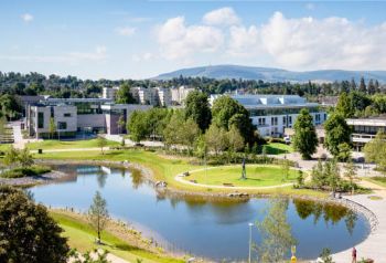
Conference Location
|
|
Getting to Dublin and UCD 
Planning your route
Hit the Road shows you how to get to or from the UCD Campus using a combination of Dublin Bus, Luas and DART links (see also below). You can also change searching options and search how to get from point A to B anywhere in Dublin.
The UCD Commuting Services Map shows all the bus stops in and around UCD, all DART, LUAS and train stations(see also below), as well as car, bicycle and disabled parking areas on campus. You can get directions directly to those points and also check the real time information in some of the stops.
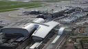
By Plane


|
Arriving by plane into Ireland, you will most probably land at Dublin Airport which is located north of Dublin city, near Swords in the administrative county of Fingal. Dublin Airport is also the headquarters of Ireland's flag carrier Aer Lingus , the regional airlines Stobart Air and CityJet as well as those of low-cost carrier Ryanair. The airport offers a short and medium haul network, domestic services to regional airports in Ireland, and long-haul services to the United States, Canada, the Middle East and Hong Kong. Alternatively you can arrive via Shannon Airport and make your way by public transport to Dublin. Bus from Airport Several bus companies connect Dublin Airport to Dublin city centre, such as Airlink Express (Busses 757 and 747) which brings passengers directly to Busáras (Central Bus Station, Dublin) and Aircoach (Bus 700) which operates a service which passes UCD. The Aircoach bus stop at UCD is located just outside the main N11 (Stillorgan Road) entrance). Taxi from Airport Taxis are available from the forecourts directly outside Terminal 1 & Terminal 2. Passengers should follow Taxi signage to the designated taxi ranks. A taxi dispatcher is available at either taxi rank if you require any further information or assistance. |
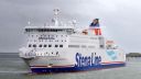
By Ferry and Train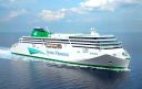
|
Dublin Connolly Station is connected by bus to Dublin Port and ferries run by Irish Ferries and Stena Line to Holyhead for connecting trains on the North Wales Coast Line to Chester, Crewe and London Euston. Dublin Connolly to Dublin Port can be reached via Amiens Street, Dublin into Store Street or by Luas via Busáras (Central Bus Station, Dublin) where Dublin Bus operates services to the Ferry Terminal. |
By Train
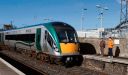
|
Heuston and Dublin Connolly stations are the two main railway termini in Dublin.
Operated by Iarnród Éireann, the Dublin Suburban Rail network consists of
five railway lines serving the Greater Dublin Area and commuter towns such as Drogheda and Dundalk in County Louth, Gorey in County Wexford, and extending as far as Portlaoise and once a day, Newry.
One of the five lines is the electrified Dublin Area Rapid Transit (DART) line, which runs primarily along the coast of Dublin, comprising 31 stations, from Malahide and Howth
southwards as far as Greystones in County Wicklow. Commuter rail operates on the other four lines using Irish Rail diesel multiple units. |
By Tram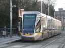
|
The Dublin new light rail system, often described as a tram system, the Luas, consists of two interconnecting lines; the Red Line links the Docklands and city centre with the south-western suburbs of Tallaght and Saggart, while the Green Line connects northern inner city suburbs and the main city centre with suburbs to the south of the city including Sandyford and Brides Glen. Together these lines comprise a total 67 stations and 44.5 kilometres (27.7 mi) of track. |
By Bus

|
Dublin is served by a network of nearly 200 bus routes which cover the city and suburbs. The majority of these are provided by Dublin Bus, with a modest number having been transferred to
Go Ahead Ireland in 2018, but a number of smaller companies also operate. Fares are generally calculated on a stage system based on distance travelled. There are several different levels
of fares, which apply on most services. A "Real Time Passenger Information" system was introduced at Dublin Bus bus stops in 2012. Electronically displayed signs relay information about
the time of the next bus' arrival based on its GPS determined position. The National Transport Authority is responsible for integration of bus and rail services in Dublin and has been
involved in introducing a pre-paid smart card, called a Leap card, which can be used on all of Dublin's public transport services.
|
By Taxi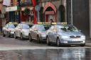 |
UCD is easily reachable by taxi. There are usually an adequate number of taxis in operation in the city centre at any given time. It is possible to hail a taxi from the street, but convenient taxi ranks are located on O'Connell Street, Middle Abbey Street, Dame Street and St Stephens Green. |
By Car |
The road network in Ireland is primarily focused on Dublin. The M50 motorway, a semi-ring road which runs around the south, west and north of the city, connects important national primary routes
to the rest of the country. A tunnel connects Dublin Port and the M1 motorway close to Dublin Airport. The city is also surrounded by an inner and outer orbital route. The inner orbital route runs
approximately around the heart of the Georgian city and the outer orbital route runs primarily along the natural circle formed by Dublin's two canals, the Grand Canal and the Royal Canal, as well as
the North and South Circular Roads. |
By Bicycle
|
Dublin City Council began installing cycle lanes and tracks throughout the city in the 1990s, and as of 2012 the city has over 200 kilometres (120 mi) of specific on- and off-road tracks for cyclists. For this purpose bikes can be rented from Dublinbikes which have their terminal in the Docklands. This self-service bicycle rental scheme consists of hundreds of unisex bicycles stationed at 44 terminals throughout the city centre. Users must make a subscription for either an annual Long Term Hire Card or purchase a three-day ticket. |
On Foot
|
All chosen hotels are within easy walking distance of UCD. (see hotel page) |

UCD Location Map